En
Menu
English
Arabic
Brazil
French
German
Italian
Russian
Simplified China
Traditional China
Spanish
Turkey
India
Vietnam
Japanese
Korean
About app
Contacts
En
English
Arabic
Brazil
French
German
Italian
Russian
Simplified China
Traditional China
Spanish
Turkey
India
Vietnam
Japanese
Korean
This section is not available yet
Home
Maps
Japan
Kyotamba
Sections
Top places
Entertainment
Park
Swimming Pool
Attractions
Viewpoint
Business
Car Shop
Lodging
Shops
Supermarket
Health
Hospital
Food
Restaurant
Education
Kindergarten
School
Transport
Gas station
Parking
Train station
Finance
Post
Car Shop
SUZUKI
1.0
Gas station
ENEOS
2.5
kirino
2.0
Hospital
瑞穂町国民健康保険瑞穂病院
1.0
和知町国民健康保険和知病院
2.5
Kindergarten
丹波町立上豊田保育所
2.0
瑞穂町立桧山保育所
2.5
Park
自然双生運動公園
2.0
わち地域交流拠点施設
2.0
Parking
いねむりパーキング
2.5
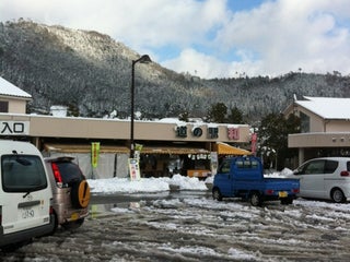
道の駅 和
3.2
坂原上モジリ11 (国道27号 沿い), Kyōtanba-chō, Kyōto, 629-1131, Japan, GPS: 35.27011,135.39731
Credit Cards
Wi-Fi
+
more
Post
三ノ宮郵便局
1.5
和知郵便局
2.0
Restaurant
茶
2.0
Shiro Gohan
1.0
Price
Outdoor Seating
+
more
School
町立明俊小学校
2.5
町立下山小学校
2.0
Supermarket
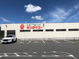
サンダイコー 下山店
下山野丸80-23, 船井郡京丹波町, Kyōto, Japan, GPS: 35.205368,135.43307
Swimming Pool
和知B&G海洋センタープール
1.5
篠原プール
2.5
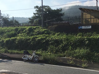
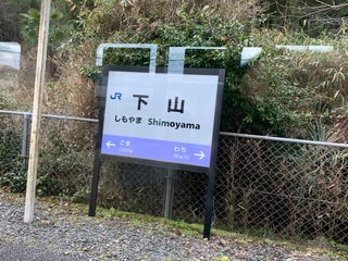
Train station
Aseri Station (安栖里駅)
安栖里萩尾21-2 (JR山陰本線), Kyōtanba-chō, Kyōto, 629-1141, Japan, GPS: 35.26605,135.38486
Shimoyama Station (下山駅)
下山小野6-4 (JR山陰本線), Kyōtanba-chō, Kyōto, 622-0201, Japan, GPS: 35.212234,135.42265
Credit Cards
+
more
Viewpoint
中央広場
2.0
Show on map
Show list
MAPS.ME
is always on hand
Download the apps and start expanding your horizons
Open Maps.me app
Use web version