En
Menu
English
Arabic
Brazil
French
German
Italian
Russian
Simplified China
Traditional China
Spanish
Turkey
India
Vietnam
Japanese
Korean
About app
Contacts
En
English
Arabic
Brazil
French
German
Italian
Russian
Simplified China
Traditional China
Spanish
Turkey
India
Vietnam
Japanese
Korean
This section is not available yet
Home
Maps
South Korea
Eoeun-dong
Sections
Top places
Entertainment
Park
Theatre
Attractions
Business
Lodging
Shops
Supermarket
Health
Dentist
Hospital
Food
Education
School
University
Transport
Gas station
Subway
Train station
Finance
ATM
Bank
ATM
Wooribank ATM
1.5
Bank
Uri Bank
1.0
Uri Bank
2.0
Dentist
Yun Dental Clinic
2.0
Gas station
Gas Station
1.0
Hospital
Gimjinyongibiinhugwa Clinic
2.0
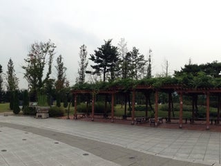
Park
Yurim Park
South Korea, GPS: 36.359802,127.35474
School
어은중학교
유성구 농대로 56 (농대길 72), 유성구, Daejeon, South Korea, GPS: 36.36572,127.35439
Subway
Wolpyeong (KAIST) 2
2.5
Wolpyeong (KAIST) 1
2.5
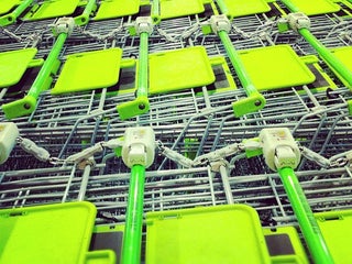
Supermarket
e-Mart Traders
1.0
Credit Cards
Wi-Fi
+
more
E-Mart Traders (이마트 트레이더스)
4.0
서구 한밭대로 580 (월평점), Daejeon, 35222, South Korea, GPS: 36.35831,127.36295
Credit Cards
Wi-Fi
+
more
Theatre
W9
2.5
KAIST 노천극장 [W9]
유성구 대학로 291, Daejeon, Daejeon, 34141, South Korea, GPS: 36.370777,127.35804
Train station
Wolpyeong (KAIST) Station
1.5
University
N7-4
2.0
Korea Advanced Institute of Science and Technology
2.0
Show on map
Show list
MAPS.ME
is always on hand
Download the apps and start expanding your horizons
Open Maps.me app
Use web version