En
Menu
English
Arabic
Brazil
French
German
Italian
Russian
Simplified China
Traditional China
Spanish
Turkey
India
Vietnam
Japanese
Korean
About app
Contacts
En
English
Arabic
Brazil
French
German
Italian
Russian
Simplified China
Traditional China
Spanish
Turkey
India
Vietnam
Japanese
Korean
This section is not available yet
Home
Maps
Argentina
Pilar, Córdoba Province
Sections
Top places
Entertainment
Park
Attractions
Business
Lodging
Hotel
Shops
Supermarket
Health
Clinic
Hospital
Food
Restaurant
Education
College
School
Transport
Airport
Gas station
Train station
Finance
Bank
Airport
Pilar Airport
1.0
Bank
Banco de la Nación Argentina
1.0
Clinic
Centro Medico Deragopian
1.0
College
Escuela de Campo 3 Árboles
1.5
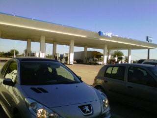
Gas station
YPF
2.7
Au. Córdoba - Rosario Km 665, Pilar, Córdoba, Argentina, GPS: -31.652418,-63.856766
Credit Cards
+
more
La Cuarta S.A.
Show more
Show less
NELIO RAUL PIGNATTA Y CIA SA
2.5
Hospital
Centro Médico Deragopyan
3.0
Panamericana Km. 52.5, B1629 Pilar, Buenos Aires, Argentina, GPS: -34.447914,-58.892162
Centro de Salud "Madre Teresa de Calcuta"
1.0
Hotel
El Messon
2.0
El Puente
1.0
Park
Fray Mamerto Esquiú
2.0
Plaza Libertad
2.5
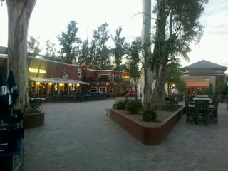
Restaurant
parrilla 5 esquinas asador
2.5
El Puente
2.5
School
C.E:Malvinas Argentinas
1.5
C.E. Malvinas Argentinas- Lagunilla
2.0
Supermarket
Complejo Torres del Sol
3.2
Panamericana Km. 50, 1669 Pilar, Buenos Aires, Argentina, GPS: -34.442856,-58.874287
Credit Cards
Wi-Fi
+
more
Almacor
1.5
Train station
Pilar
1.5
Pilar
2.5
Show on map
Show list
MAPS.ME
is always on hand
Download the apps and start expanding your horizons
Open Maps.me app
Use web version