En
Menu
English
Arabic
Brazil
French
German
Italian
Russian
Simplified China
Traditional China
Spanish
Turkey
India
Vietnam
Japanese
Korean
About app
Contacts
En
English
Arabic
Brazil
French
German
Italian
Russian
Simplified China
Traditional China
Spanish
Turkey
India
Vietnam
Japanese
Korean
This section is not available yet
Entertainment
Athletics
Basketball Pitch
Casino
Cinema
Fitness Centre
Football Pitch
Library
Multi-sport Pitch
Nightclub
Park
Pier
Sauna
Stadium
Swimming Pool
Theatre
WaterPark
Zoo
Attractions
Attraction
Castle
Church
Memorial
Monument
Mosque
Museum
Synagogue
Temple
Tomb
Viewpoint
Wayside Shrine
Business
Car Parts
Car Shop
Car Wash
Company Office
Dry Cleaning
Hairdresser
Laundry
Lawyer
Optician's
Tyre Repair
Lodging
Apartments
Camping
Guesthouse
Hostel
Hotel
Motel
Shops
Bakery
Beauty Shop
Bookstore
Butcher's
Chemist Shop
Clothes shop
Computer Store
Department Store
Florist's
Furniture Store
Gift Shop
Hardware store
Jewerly
Kiosk
Liquor Store
Mall
Marketplace
Petshop
Photo Shop
Shoe Store
Sports Goods
Supermarket
Sweets
Ticket Shop
Toy Store
Wine Shop
Health
Clinic
Dentist
Doctor
Hospital
Pharmacy
Veterinary doctor
Food
Bar
Cafe
Fast Food
Pub
Restaurant
Education
College
Kindergarten
School
University
Transport
Airport
Bus station
Car Rental
Car Sharing
Gas station
Parking
Subway
Taxi
Train station
Finance
ATM
Bank
Post
Home
Catalog
Education
School
Wi-Fi
$
$$
$$$
$$$$
Wheelchair active
Clear
School nearby Walderslade
14 found
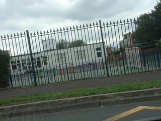
Swingate Infant & Nursery School
2.0
Horsted Infant School
United Kingdom, GPS: 51.350048,0.51094913
Silverbank Park
2.5
Greenacre Academy
Kent, United Kingdom, GPS: 51.35039,0.52607775
Spinnens Acre Community Junior School
0.5
We found more than 15 Education points in Walderslade. Including
14
School
1
Kindergarten
Oaklands School
Weedswood road, Kent, United Kingdom, GPS: 51.346565,0.5237818
Thomas More School.
Bleakwood Road, United Kingdom, GPS: 51.347744,0.5265713
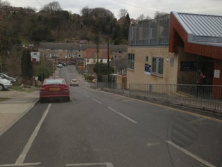
Tunbury Primary School
United Kingdom, GPS: 51.3336,0.5213046
Walderslade Girls School
United Kingdom, GPS: 51.351234,0.52605045
Walderslade Primary School
United Kingdom, GPS: 51.342556,0.52865267
Bradfields School
Churchill Avenue, Chatham, Kent, ME5 0LB, United Kingdom, GPS: 51.35265,0.5268717
Lordswood Primary School
Lordswood Lane, Kent, United Kingdom, GPS: 51.340996,0.5379224
Saint Benedict's Roman Catholic Primary School
0.5
Maundene School
1.5
More School in other Cities
School Nearby Winsford
School Nearby Butayunja
School Nearby Muttontown
School Nearby Dusun Jangkih Jawe
School Nearby Steimbke
School Nearby Ombai
Interesting places in Walderslade
Church Nearby Walderslade
Fast Food Nearby Walderslade
Supermarket Nearby Walderslade
Hairdresser Nearby Walderslade
Library Nearby Walderslade
Parking Nearby Walderslade
Search this area
Show on map
Show list
MAPS.ME
is always on hand
Download the apps and start expanding your horizons
Open Maps.me app
Use web version