En
Menu
English
Arabic
Brazil
French
German
Italian
Russian
Simplified China
Traditional China
Spanish
Turkey
India
Vietnam
Japanese
Korean
About app
Contacts
En
English
Arabic
Brazil
French
German
Italian
Russian
Simplified China
Traditional China
Spanish
Turkey
India
Vietnam
Japanese
Korean
This section is not available yet
Home
Maps
Poland
Rudy
Sections
Top places
Entertainment
Park
Stadium
Attractions
Attraction
Church
Memorial
Museum
Wayside Shrine
Business
Lodging
Hotel
Shops
Bookstore
Clothes shop
Florist's
Health
Pharmacy
Food
Bar
Cafe
Fast Food
Restaurant
Education
School
Transport
Gas station
Train station
Finance
Post
Attraction
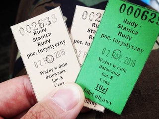
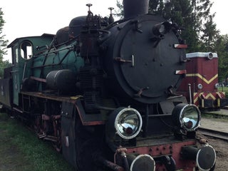
Zabytkowa Stacja Kolei Wąskotorowej
Poland, GPS: 50.189877,18.464352
Bar
Malinka
2.5
Bookstore
Na Szlaku
2.0
Cafe
Przystanek smaku "Kuki"
1.5
ice cream
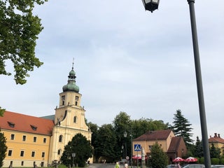
Church
Bazylika mniejsza pw. Wniebowzięcia NMP w Rudach
Cysterska 4, 47-430 Rudy, Poland, GPS: 50.19402,18.448063
Kościół św. Marii Magdaleny
2.0
Clothes shop
SHP
2.5
Fast Food
Stacyjkowo
1.5
Florist's
Margo
1.5
Orchidea
1.0
Gas station
AKTYWNA
2.0
Hotel
Pod Dębem
2.5
Memorial
Unseren Helden 1914-1918
2.5
Dra. Juliusza Rogera
1.0
Museum
Pocysterski Zespół Klasztorno-Pałacowy w Rudach
Cysterska 2, 47-430 Rudy, Poland, GPS: 50.194458,18.447483
Etno Muzeum - Zaczarowana Chata
47-430 Rudy, Poland, GPS: 50.19167,18.460287
Park
Park klasztorno-pałacowy
1.5
Pharmacy
Esculap
2.5
Post
Poczta
1.0
Restaurant
Na Poddaszu
1.0
regional
Pałacowa
0.5
regional
School
Szkoła Podstawowa i Gimnazjum im. Jana III Sobieskiego
1.0
Młodzieżowy Ośrodek Wychowawczy w Rudach
1.0
Stadium
LKS Buk Rudy
2.5
Train station
Rudy
Rudy Raciborskie, Poland, GPS: 50.190132,18.464113
Wayside Shrine
Kapliczka Chrystusa Ukrzyżowanego "Arma Christi"
1.5
Show on map
Show list
MAPS.ME
is always on hand
Download the apps and start expanding your horizons
Open Maps.me app
Use web version