En
Menu
English
Arabic
Brazil
French
German
Italian
Russian
Simplified China
Traditional China
Spanish
Turkey
India
Vietnam
Japanese
Korean
About app
Contacts
En
English
Arabic
Brazil
French
German
Italian
Russian
Simplified China
Traditional China
Spanish
Turkey
India
Vietnam
Japanese
Korean
This section is not available yet
Home
Maps
Namibia
Keetmanshoop
Sections
Top places
Entertainment
Park
Stadium
WaterPark
Attractions
Attraction
Church
Monument
Viewpoint
Business
Lodging
Camping
Guesthouse
Hostel
Hotel
Shops
Butcher's
Gift Shop
Liquor Store
Supermarket
Health
Hospital
Food
Bar
Fast Food
Restaurant
Education
School
Transport
Airport
Gas station
Parking
Train station
Finance
ATM
ATM
First Nationl Bank
0.5
Airport
Keetmanshoop Airport
2.5
Keetmanshoop Airport
1.5
Attraction
game viewing
2.0
Eisenbahn
2.0
Bar
Karas Take away
1.5
Butcher's
Brukkaros Meat Processors
2.0
Camping
Quivertree Forest Rest Camp Campsite
2.5
Maritz Campsite
2.5
Church
Kirche der Rheinischen Mission
2.5
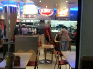
Fast Food
KFC
0.5
american
Wimpy
$
Keetmanshoop, Namibia, GPS: -26.61182,18.165894
Price
+
more
Gas station
Puma
2.0
Puma
2.0
Gift Shop
Keetmanshoop Craft Market
2.0
Guesthouse
Gesserts Guesthouse
2.5
At Home
2.0
Hospital
Keetmanshoop State Hospital
2.5
Hostel
Rachels Backpackers
2.5
Hotel
Maritz Country Lodge
1.5
Luxury #3 & #4
2.0
Liquor Store
Tops
2.0
Monument
Eagle Monument
1.0
Kaiserliche Post
2.0
Park
Central Lodge Keetmanshoop
Keetmanshoop, Namibia, GPS: -26.577229,18.133131
Credit Cards
+
more
Parking
Keetmanshoop Airport (KMP)
Airport, Keetmanshoop, Namibia, GPS: -26.539087,18.108994
Giants Playground
1.0
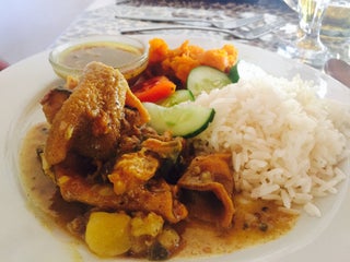
Restaurant
Schützenhaus
2.5
School
J A Nel Government School
2.0
Krolein Primary School
2.5
Stadium
J. Stephanus Stadium
1.0
Supermarket
Spar
2.5
Shoprite
2.5
Train station
Gobas
2.0
Keetmanshoop
2.5
Viewpoint
Giants Playground
2.0
WaterPark
Keetmanshoop Public Swimming Pool
1.5
Show on map
Show list
MAPS.ME
is always on hand
Download the apps and start expanding your horizons
Open Maps.me app
Use web version