En
Menu
English
Arabic
Brazil
French
German
Italian
Russian
Simplified China
Traditional China
Spanish
Turkey
India
Vietnam
Japanese
Korean
About app
Contacts
En
English
Arabic
Brazil
French
German
Italian
Russian
Simplified China
Traditional China
Spanish
Turkey
India
Vietnam
Japanese
Korean
This section is not available yet
Home
Maps
Brazil
Laranjeiras do Sul
Sections
Top places
Entertainment
Park
Stadium
Attractions
Church
Monument
Business
Lodging
Guesthouse
Hotel
Shops
Health
Hospital
Food
Bar
Restaurant
Education
School
University
Transport
Bus station
Gas station
Finance
Bar
Refrescante caldo de cana
2.5
Bus station
Rodoviária
2.5
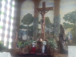
Church
Santuário Nossa Senhora Aparecida
Brazil, GPS: -25.387903,-52.411846
Igreja Matriz de Laranjeiras do Sul
Rua Santana, Laranjeiras do Sul, PR, 85301-200, Brazil, GPS: -25.407993,-52.416092
Gas station
Posto Palmeiras
3.5
Rod. BR-277, km 452, Laranjeiras do Sul, PR, Brazil, GPS: -25.377747,-52.396214
Credit Cards
+
more
Guesthouse
Garda Hotel
3.8
Brazil, GPS: -25.394682,-52.40897
Hospital
Hospital São José
Brazil, GPS: -25.403006,-52.41505
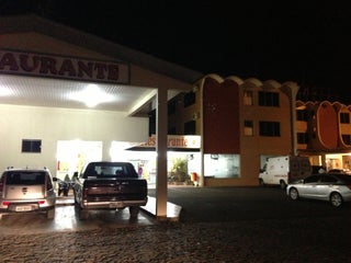
Hotel
Hotel Palmeiras
0.5
Credit Cards
+
more
Sandro Hotel
0.5
Credit Cards
+
more
Monument
Cristo Rei
1.5
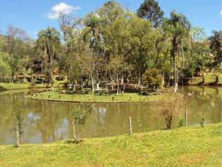
Park
Pesca da Ilha
3.8
$$
Brazil, GPS: -25.394802,-52.419876
Price
+
more
Parque Alcindo Natel de Camargo
0.5
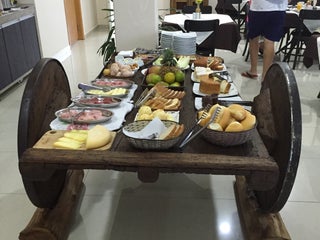
Restaurant
Hotel Palmeiras
3.1
Rod. BR-277, km 452 (Posto Palmeiras), Laranjeiras do Sul, PR, Brazil, GPS: -25.377369,-52.396687
Credit Cards
+
more
Point Restaurante
4.1
regional $$
Laranjeiras do Sul, PR, Brazil, GPS: -25.40623,-52.415146
Price
+
more
School
Colégio Estadual Marechal Floriano Peixoto
1.5
Centro de Sócio-Educação
1.5
Stadium
Estádio Primeiro de Maio
1.5
University
UFFS
2.0
Show on map
Show list
MAPS.ME
is always on hand
Download the apps and start expanding your horizons
Open Maps.me app
Use web version