En
Menu
English
Arabic
Brazil
French
German
Italian
Russian
Simplified China
Traditional China
Spanish
Turkey
India
Vietnam
Japanese
Korean
Menu
By countries
By cities
Catalog
Maps
Maps
By countries
By cities
Contacts
About app
Wallet
Rewards
En
English
Arabic
Brazil
French
German
Italian
Russian
Simplified China
Traditional China
Spanish
Turkey
India
Vietnam
Japanese
Korean
Home
Maps
Australia
Red Cliffs
Sections
Top places
Entertainment
Library
Attractions
Attraction
Business
Lodging
Camping
Motel
Shops
Health
Food
Education
School
Transport
Gas station
Parking
Train station
Finance
Attraction
Gypsum Mound
2.0
Camping
Emmerts Bend
1.5
Bottle Bend Forest Picnic Area
2.0
Gas station
Shell
2 Ilex Street, Red Cliffs VIC 3496, Australia, GPS: -34.305176,142.18753
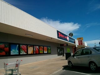
Fishers Red Cliffs
1-13 Ilex Street, Red Cliffs VIC 3496, Australia, GPS: -34.30541,142.18819
Library
A.S. Kenyon Library
Australia, GPS: -34.308388,142.18707
Motel
Red Cliffs Colonial Motor Lodge
Red Cliffs VIC 3496, Australia, GPS: -34.305367,142.18713
Parking
Tristar Medical Centre Red Cliffs
Australia, GPS: -34.308697,142.1895
School
Red Cliffs Primary School
2.0
Red Cliffs East Primary School
1.0
Train station
Boonoonar (closed 1955)
2.5
Yatpool (closed 1960)
2.5
Show on map
Show list
MAPS.ME
is always on hand
Download the apps and start expanding your horizons
Open Maps.me app
Use web version