En
Menu
English
Arabic
Brazil
French
German
Italian
Russian
Simplified China
Traditional China
Spanish
Turkey
India
Vietnam
Japanese
Korean
Menu
By countries
By cities
Catalog
Maps
Maps
By countries
By cities
Contacts
About app
Wallet
Rewards
En
English
Arabic
Brazil
French
German
Italian
Russian
Simplified China
Traditional China
Spanish
Turkey
India
Vietnam
Japanese
Korean
Entertainment
Athletics
Basketball Pitch
Casino
Cinema
Fitness Centre
Football Pitch
Library
Multi-sport Pitch
Nightclub
Park
Pier
Sauna
Stadium
Swimming Pool
Theatre
WaterPark
Zoo
Attractions
Attraction
Castle
Church
Memorial
Monument
Mosque
Museum
Synagogue
Temple
Tomb
Viewpoint
Wayside Shrine
Business
Car Parts
Car Shop
Car Wash
Company Office
Dry Cleaning
Hairdresser
Laundry
Lawyer
Optician's
Tyre Repair
Lodging
Apartments
Camping
Guesthouse
Hostel
Hotel
Motel
Shops
Bakery
Beauty Shop
Bookstore
Butcher's
Chemist Shop
Clothes shop
Computer Store
Department Store
Florist's
Furniture Store
Gift Shop
Hardware store
Jewerly
Kiosk
Liquor Store
Mall
Marketplace
Petshop
Photo Shop
Shoe Store
Sports Goods
Supermarket
Sweets
Ticket Shop
Toy Store
Wine Shop
Health
Clinic
Dentist
Doctor
Hospital
Pharmacy
Veterinary doctor
Food
Bar
Cafe
Fast Food
Pub
Restaurant
Education
College
Kindergarten
School
University
Transport
Airport
Bus station
Car Rental
Car Sharing
Gas station
Parking
Subway
Taxi
Train station
Finance
ATM
Bank
Post
Home
Catalog
Education
School
Wi-Fi
$
$$
$$$
$$$$
Wheelchair active
Clear
School nearby Croydon
128 found
Elmwood Junior School
1.5
St Thomas Becket Catholic Primary School
2.0
Lodge School
1.5
Whitehorse Manor Schools - Brigstock Site
2.0
Gilbert Scott Primary School
0.5
We found more than 150 Education points in Croydon. Including
128
School
16
Kindergarten
6
College
Wilsons
Mollison Dr., Surrey, SM6 9JW, United Kingdom, GPS: 51.358864,-0.12873259
Beckmead School
United Kingdom, GPS: 51.37653,-0.0293729
Selsdon Spice
$$
Addington Road, South Croydon, Greater London, CR2, United Kingdom, GPS: 51.347187,-0.053382
Price
Credit Cards
Parking
Restroom
+
more
Saffron Valley Collegiate
1.0
Riddlesdown Collegiate
Dunmail Drive, Surrey, CR8 1EX, United Kingdom, GPS: 51.32565,-0.08801695
Collingwood Junior School
2.0
Regina Coeli Catholic Primary School
Pampisford Road, Croydon, Greater London, United Kingdom, GPS: 51.353497,-0.106078535
Trinity School
Shirley Park, Croydon, Greater London, CR9 7AT, United Kingdom, GPS: 51.37513,-0.06018877
Al-Khair School
Cherry Orchard Road, Croydon, Greater London, CR 0 6, United Kingdom, GPS: 51.38019,-0.08779455
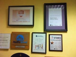
Parish Church CE Junior School
Warrington Road, Surrey, CR0 4BH, United Kingdom, GPS: 51.369846,-0.11012374
Wallington High School for Girls
United Kingdom, GPS: 51.34687,-0.14842318
Winterbourne Junior Girls' School
1.0
Benson primary
United Kingdom, GPS: 51.370716,-0.0429961
Harris Academy South Norwood
Harris Academy South Norwood, Cumberlow Avenue Sou (Cumberlow Avenue), South Norwood, Greater London, SE25 6AE, United Kingdom, GPS: 51.40077,-0.07446016
Edenham High School
2.5
Link Secondary School
2.5
Park Hill Infants School
United Kingdom, GPS: 51.371044,-0.08898979
Hackbridge Cafe
$
United Kingdom, GPS: 51.37897,-0.15545855
Price
+
more
Thomas more catholic school
Croydon, Greater London, United Kingdom, GPS: 51.343582,-0.11992256
Wallington County Grammar School
United Kingdom, GPS: 51.368935,-0.14855132
More School in other Cities
School Nearby Stockton
School Nearby Kecamatan Gunungsari
School Nearby Pellenberg
School Nearby Irthlingborough
School Nearby Schönbrunn
School Nearby Ban Dai Chum Saeng
Interesting places in Croydon
Fast Food Nearby Croydon
Pub Nearby Croydon
Clothes Shop Nearby Croydon
Train Station Nearby Croydon
Optician’s Nearby Croydon
Butcher’s Nearby Croydon
Search this area
Show on map
Show list
MAPS.ME
is always on hand
Download the apps and start expanding your horizons
Open Maps.me app
Use web version